Projects
Undercover Initiative
The vast majority of exploration at Kharmagtai has focused on the outcropping porphyry deposits. Approximately 70-80% of the prospective intrusive rocks are covered by a shallow layer of post mineralisation sediments and sand. Historically these shallow sediments have made exploration targeting difficult as the prospective rocks cannot be seen or sampled via conventional means. Additionally, a thin layer of conductive clays at the base of the cover interferes with IP (induced polarisation) surveys, a common porphyry exploration geophysical technique and drill targeting in the covered areas was mainly based on drilling magnetic targets.
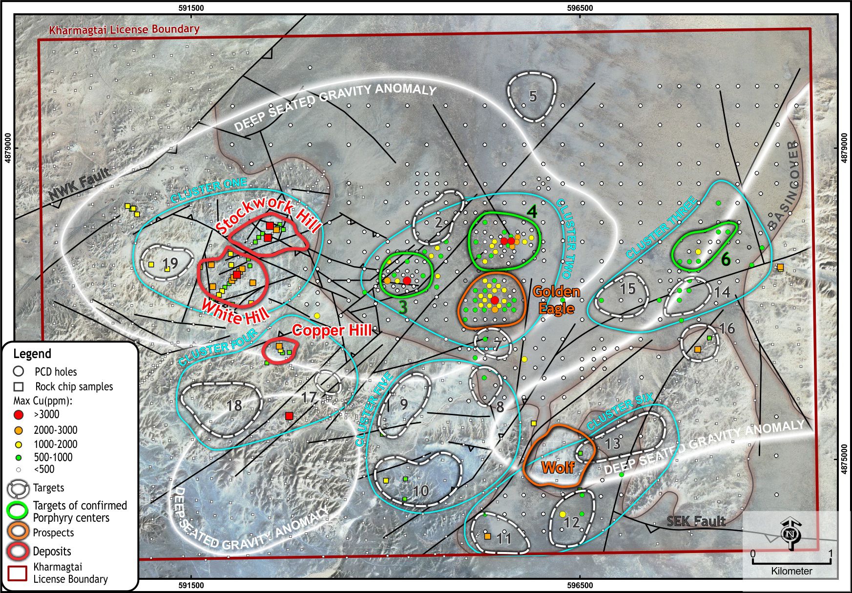
More recently, a gridded geochemical program was designed to see through this cover. Using low cost rotary mud drilling through the cover and six metres of diamond core into the prospective basement rocks has provided geochemistry, geology and density data for targeting. Initially this program was designed on a 500m by 500m grid as this grid would be sufficient to obtain a single point geochemical anomaly from Stockwork Hill, should that deposit have been covered. Areas of interest were infilled to 250m spaced samples and finally to 125m in areas of high-density veining and anomalous geochemistry.
To compliment this new geochemistry a grid of rock chips was collected from the areas of outcropping protective geology allowing a geochemical map of the entire mining lease to be created.
Initial targeting from this new dataset focuses on copper and gold anomalism. However, advances in the understanding of the geochemistry of porphyry deposits allow a more sophisticated approach to be taken.
Porphyry deposits form when copper and gold rich fluids are released from the top of a fractionating magma chamber at depth. As these fluids cool and change chemistry the copper and gold is precipitated forming the deposit. The spent fluids however keep moving away from the deposit site precipitating other elements in a sequence as the fluid cools. These other elements can be used as vectors towards buried porphyry deposits.
These geochemical patterns have been characterised in a study completed by Cohen, 2011 for a copper molybdenum porphyry deposit in Nevada (figure below).
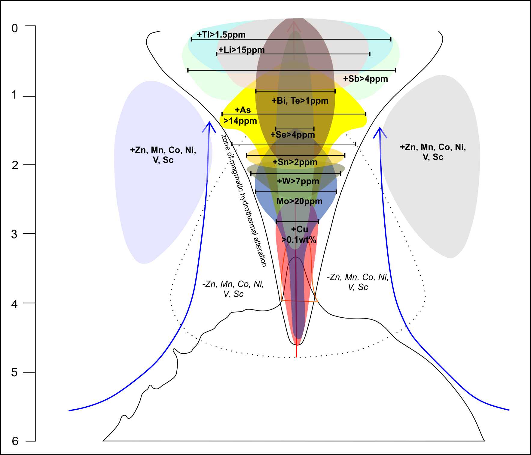
Using this model, anomalies in vector elements such as Mo, W and Sn point to a shallowly buried porphyry target. Bismuth and Tellurium anomalies indicate a slightly deeper porphyry target and Lithium and Thallium and deeper target still.
The complete surface geochemical dataset has now been returned and is currently being interpreted to build a suite of 3D geochemical targets to be combined with the geology and geophysics.